| 出版社 | MarketsandMarkets |
| 出版年月 | 2025年7月 |
Geospatial Imagery Analytics Market – Global Forecast To 2030
本調査レポートは、地理空間画像分析市場を、提供内容、データモダリティ、データソース、および業種に基づいてセグメント化して調査しています。提供内容セグメントは、ソフトウェアとサービスで構成されています。ソフトウェアセグメントには、機能別ソフトウェア(画像処理および拡張、オブジェクト追跡および特徴検出、変化検出および時系列分析、予測モデリングおよびパターン認識、AIベースの地理空間画像分析、その他(異常検出およびストリーム分析))と導入モード別ソフトウェア(クラウドおよびオンプレミス)が含まれます。サービスセグメントは、プロフェッショナルサービス(コンサルティングおよびアドバイザリ、導入および統合、サポートおよび保守)とマネージドサービスで構成されています。データモダリティセグメントには、画像ベースの分析、ビデオベースの分析、およびマルチモーダル分析が含まれます。データソースセグメントは、衛星画像、合成開口レーダー(SAR)、航空画像、UAV/ドローン、GISおよびマッピングプラットフォーム、その他(クラウドソーシング画像および気球ベースシステム)で構成されています。アプリケーションセグメントには、監視とモニタリング、環境モニタリングと気候変動、土地利用と土地被覆(LULC)分類、資産とインフラ管理、保険リスク評価とクレーム検証、災害管理と緊急対応、精密農業と作物モニタリング、都市計画、スマートシティとインフラ、ターゲット検出と戦略的インテリジェンス、サプライチェーンと物流のモニタリング、疾病発生の追跡と資源配分、小売サイトの選定と消費者の足取りのマッピング、その他のアプリケーション(サイトの保全とモニタリング、メディアと視聴者のマッピング、通信ネットワークの計画)が含まれます。垂直セグメントは、保険、農業、建設と不動産、鉱業、ヘルスケアとライフサイエンス、エネルギーと公共事業、政府と防衛、通信、運輸と物流、メディアとエンターテインメント、その他の垂直(銀行と金融サービス、小売とeコマース、製造)で構成されています。地理空間画像分析市場の地域分析は、北米、ヨーロッパ、アジア太平洋、中東とアフリカ(MEA)、ラテンアメリカをカバーしています。レポートには、投資および資金調達のシナリオ、ケーススタディ、規制環境、エコシステム分析、サプライチェーン分析、価格分析、テクノロジー分析の詳細な分析も含まれています。
The geospatial imagery analytics market is projected to grow from USD 12.12 billion in 2025 to USD 18.55 billion by 2030 at a CAGR of 8.9% during the forecast period. The market is experiencing robust growth, driven by rising demand for satellite and drone-based imaging across sectors such as agriculture, defense, urban planning, and disaster management. Innovations in AI and machine learning have enhanced image interpretation, enabling faster, more precise decision-making. Governments and private enterprises increasingly rely on geospatial data for infrastructure monitoring, climate analysis, and security surveillance. Cloud integration and real-time analytics further expand usability and scalability. However, the market faces restraints, including high initial investment costs, limited access to high-resolution data in developing regions, and growing privacy concerns related to constant surveillance and geospatial tracking.
地理空間画像分析市場は、予測期間中に年平均成長率(CAGR)8.9%で成長し、2025年の121億2,000万米ドルから2030年には185億5,000万米ドルに達すると予測されています。農業、防衛、都市計画、防災などの分野における衛星画像やドローン画像への需要の高まりに牽引され、市場は力強い成長を遂げています。AIと機械学習の革新により画像解釈が向上し、より迅速かつ正確な意思決定が可能になっています。政府機関や民間企業は、インフラ監視、気象分析、セキュリティ監視において、地理空間データへの依存度を高めています。クラウド統合とリアルタイム分析により、使いやすさと拡張性がさらに向上しています。しかしながら、市場は初期投資コストの高さ、発展途上地域における高解像度データへのアクセスの制限、常時監視や地理空間追跡に関連するプライバシーへの懸念の高まりなど、制約に直面しています。
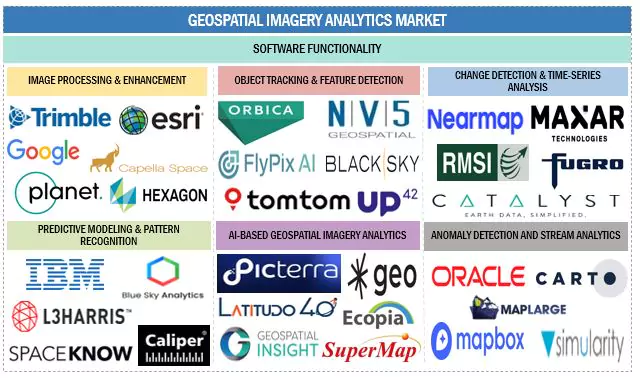
The report includes the study of key players offering geospatial imagery analytics solutions and services. It profiles major vendors in the geospatial imagery analytics market. The major market players include Google (US), IBM (US), Hexagon AB (Sweden), TomTom (Netherlands), Maxar Technologies (US), Trimble (US), Oracle (US), ESRI (US), RMSI (India), Furgo (Netherlands), Planet Labs (US), BlackSky (US), L3Harris Technologies (US), Mapbox (US), Carto (US), SuperMap (China), NV5 Geospatial (US), Nearmap (Australia), Caliper Corporation (US), EOS Data Analytics (US), Sparkgeo (Canada), Orbica (New Zealand), Blue Sky Analytics (Netherlands), Latitude 40 (Italy), Ecopia.AI (Canada), Catalyst (Canada), SpaceKnow (US), Flypix AI (Germany), Picterra (Switzerland), Geospatial Insight (UK), UP42 (Germany), Simularity (US), MapLarge (US), EarthDaily Analytics (Canada), and Capella Space (US).
geospatial-imagery-analytics-market-ecosystem
Key Benefits of Buying the Report
The report would provide the market leaders/new entrants in this market with information on the closest approximations of the revenue numbers for the overall geospatial imagery analytics market and its subsegments. It would help stakeholders understand the competitive landscape and gain more insights to position their business and plan suitable go-to-market strategies. It also helps stakeholders understand the market’s pulse and provides information on key market drivers, restraints, challenges, and opportunities.
The report provides insights on the following pointers:
- Analysis of key drivers (Proliferation of Satellite and UAV Imagery, Growing adoption of location-based services across industries, increasing Industry-Specific Use Cases, Advancements in AI/ML & Cloud Computing), restraints (Data Privacy and Security Concerns, Regulatory and Airspace Constraints, Complexities in integration and standardization of geospatial data), opportunities (Climate Monitoring and ESG Reporting, Expansion of Commercial Satellite Constellations, Customization and On-Demand Analytics Services), and challenges (Temporal and Spatial Resolution Tradeoffs, Quality and Accuracy Variability).
- Product Development/Innovation: Detailed insights on upcoming technologies, research & development activities, and new product & service launches in the geospatial imagery analytics market.
- Market Development: Comprehensive information about lucrative markets – the report analyses the geospatial imagery analytics market across varied regions.
- Market Diversification: Exhaustive information about new products & services, untapped geographies, recent developments, and investments in the geospatial imagery analytics market.
- Competitive Assessment: In-depth assessment of market shares, growth strategies and service offerings of leading players like Google (US), IBM (US), Hexagon AB (Sweden), TomTom (Netherlands), Maxar Technologies (US), Trimble (US), Oracle (US), ESRI (US), RMSI (India), Furgo (Netherlands), Planet Labs (US), BlackSky (US), L3Harris Technologies (US), Mapbox (US), Carto (US), SuperMap (China), NV5 Geospatial (US), Nearmap (Australia), Caliper Corporation (US), EOS Data Analytics (US), Sparkgeo (Canada), Orbica (New Zealand), Blue Sky Analytics (Netherlands), Latitude 40 (Italy), Ecopia.AI (Canada), Catalyst (Canada), SpaceKnow (US), Flypix AI (Germany), Picterra (Switzerland), Geospatial Insight (UK), UP42 (Germany), Simularity (US), MapLarge (US), EarthDaily Analytics (Canada), Capella Space (US) among others in the geospatial imagery analytics market. The report also helps stakeholders understand the pulse of the geospatial imagery analytics market and provides them with information on key market drivers, restraints, challenges, and opportunities.